

India Has Over 1,300 Islands — So Why Does Almost Nobody Know More Than Two Names?
A simple, student-friendly guide to India’s islands — explained the way a good geography teacher would explain it, using a map, a story, and a lot of curiosity.
The Map Question That Silenced My Geography Class
A few years ago, I was teaching a Class 9 geography lesson on the physical features of India, and I asked a question I thought was fairly easy: “Can anyone name three groups of islands that belong to India?” A boy named Kabir, usually one of the most confident students in the room, answered instantly, “Andaman and Nicobar, sir.” Then he stopped. He looked around the class, waiting for someone else to add a second name. Nobody did. Thirty-two students, all of whom could recite the names of Indian rivers, mountain ranges, and state capitals without hesitation, could not name a second island group belonging to their own country.
That silence stayed with me longer than I expected. It wasn’t that these students were careless or uninterested in geography. It was that islands, as a topic, had always been taught to them as a side note — a small paragraph squeezed between the chapter on mountains and the chapter on rivers, worth two marks and quickly forgotten. Nobody had ever asked them to actually picture India’s shape properly: a country that isn’t just a solid block of land, but one surrounded by scattered pieces of land in two very different seas, each with its own story.
So instead of moving on to the next topic that day, I pulled up a map and asked a very different kind of question: “If India has thousands of kilometres of coastline, do you think the country simply stops at the coast, or does it continue in pieces, further out into the sea?” That question turned into one of the most engaging lessons I have taught in over fifteen years in the classroom, and it is the same question this blog post is built around.
In this post, we are going to walk through what islands in India actually are, why they matter for far more than a geography exam, how different island groups were formed, a real classroom story of a student who turned this topic around, the mistakes students commonly make, a side-by-side comparison of India’s two major island territories, and five study strategies that will help this topic stick in your memory long after the exam is over.
Why We Are Starting With a Silence, Not a Definition
I could have opened this post with a formal definition — “an island is a piece of land surrounded by water on all sides” — and moved straight into facts. But that is exactly how most students first meet this topic, and it is exactly why so many of them forget it within a week. Kabir’s silence in that classroom wasn’t a lack of intelligence; it was a gap between memorized facts and real understanding. The goal of this post is to close that gap, the same way it closed for that entire class once we actually looked at a map together instead of a textbook paragraph.
I have noticed the same pattern across nearly every batch I have taught since. Students can usually recall that India “has some islands” the way they recall that India “has some deserts,” as a vague background fact rather than something concrete. But the moment you place a real map in front of them and ask them to physically point to where these islands sit, something shifts. They start noticing that India’s shape on a map is not a single tidy outline, but a mainland accompanied by scattered pieces of land, each with its own weather, its own history, and its own reason for existing exactly where it does.
What Are the Islands in India, Exactly?
An island, in the simplest possible words, is a piece of land completely surrounded by water. It can be tiny enough to fit a single lighthouse, or large enough to hold entire towns, airports, and forests. India, being a country with a long coastline stretching along the Arabian Sea, the Bay of Bengal, and the Indian Ocean, naturally has a large number of islands scattered around its mainland, in addition to a few unusual islands sitting inside its rivers.
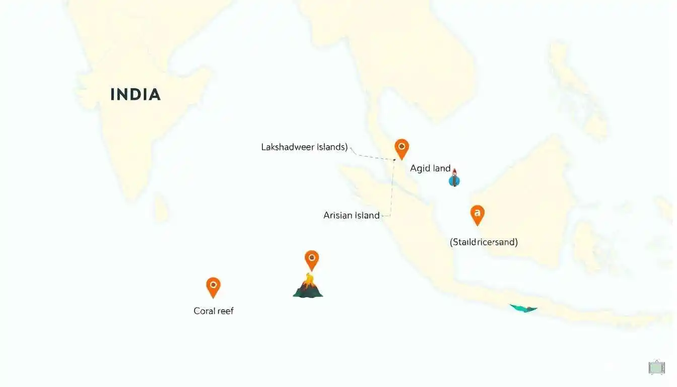
According to government and geographical survey data, India has more than 1,300 islands in total, though the vast majority of them are small, uninhabited, and rarely mentioned outside specialist maps. The two most important and exam-relevant island groups are the Andaman and Nicobar Islands, located far out in the Bay of Bengal, and the Lakshadweep Islands, located in the Arabian Sea, closer to the coast of Kerala. Beyond these two major groups, India also has smaller but historically and scientifically important islands like Majuli in the Brahmaputra river, Elephanta Island near Mumbai, and Sriharikota on the eastern coast, home to India’s main space launch centre.
The One-Line Idea That Makes This Topic Click
India is not just a single connected landmass. It is a mainland plus a scattering of island territories in two different seas, each formed differently, each serving a different purpose, and each worth knowing by more than just its name.
Once a student holds on to that one sentence, the entire topic reorganizes itself in their head. Instead of trying to memorize a random list of island names, they start sorting islands into groups based on where they are and how they were formed — which is precisely the kind of thinking that makes geography answers score well in exams, because it shows understanding rather than rote recall.
Why This Topic Matters More Than a Two-Mark Question
It would be easy to treat India’s islands as a minor detail, something you learn for an exam and never think about again. But once you look closer, these small pieces of land carry a surprising amount of weight — economically, environmentally, and strategically.
Islands like the Andaman and Nicobar group sit at a location that gives India a major strategic advantage, close to important international shipping routes connecting the Indian Ocean to the Strait of Malacca and Southeast Asia. Lakshadweep, though much smaller in size, extends India’s maritime boundary far into the Arabian Sea, giving the country rights over a much larger area of ocean resources than the mainland coastline alone would allow. In simple terms, every island India holds adds to something called the Exclusive Economic Zone, the area of sea around a country where it has special rights to fish, drill, and explore — and a country with more islands generally controls a much larger stretch of ocean than its land area alone would suggest.
These islands are also environmentally important far beyond their size. The coral reefs surrounding Lakshadweep and parts of the Andaman group support marine biodiversity found almost nowhere else in India, while the dense forests of the Andaman and Nicobar Islands are home to indigenous tribal communities and rare species that have lived in near isolation for thousands of years. Majuli, the river island in Assam, holds centuries-old Vaishnavite culture and satras (monasteries) that exist nowhere else in the world, making it not just a geography topic but a genuinely important piece of Indian heritage.
This is exactly why this topic keeps returning in exams in different forms — as a straightforward location-based question, as a case study on coral reef degradation, as a current-affairs question about a cyclone or a new port project, or as an application question linking islands to India’s maritime boundaries. Students who understand the underlying ideas, rather than a memorized list, are the ones who can answer all of these versions confidently.
There is also a growing economic story attached to these islands that textbooks rarely spend enough time on. Tourism to the Andaman and Nicobar Islands and Lakshadweep has expanded considerably over the past decade, bringing income, infrastructure development, and international attention to regions that were once considered remote and difficult to reach. New airports, better ferry connectivity, and improved digital infrastructure have slowly turned these island territories from isolated outposts into genuine centres of economic activity, while also raising real questions about how much development these fragile ecosystems can absorb without damaging the very features that make them worth visiting in the first place. That tension, between growth and preservation, is itself a valuable discussion point for any student studying these islands seriously rather than superficially.
Core Concepts: Types of Islands and How They Are Formed
Let’s slow down here and build this properly, the way I built it on the whiteboard for Kabir’s class, because this is the section that turns memorized names into real understanding.
1. Continental and Volcanic Islands — The Andaman and Nicobar Group
The Andaman and Nicobar Islands sit in the Bay of Bengal and are believed to be the exposed peaks of an underwater mountain range, part of the same geological system that runs through Myanmar down towards Indonesia. This makes most of these islands continental and tectonic in origin, formed by the movement of the Earth’s crust rather than by coral growth alone. Officially, this island group is made up of 572 islands, islets, and rocks, though only around 37 of them are permanently inhabited, and the rest remain forested, uninhabited, or restricted for the protection of indigenous tribal communities.
One island in this group deserves a special mention: Barren Island, which is India’s only confirmed active volcano. It sits quietly in the Andaman Sea and has erupted several times in recent decades, making it one of the rare places in the country where students can actually study an active volcanic landform that belongs to India itself, rather than reading about volcanoes only from other continents.
2. Coral Islands — The Lakshadweep Group
Lakshadweep, located in the Arabian Sea off the coast of Kerala, tells a completely different geological story. These islands are coral in origin, built up over thousands of years by tiny marine organisms called coral polyps, whose skeletons accumulate to form reefs and eventually low-lying islands and atolls. Lakshadweep is India’s smallest Union Territory, made up of 36 islands with a total land area of only about 32 square kilometres, of which just 10 islands are inhabited. Its capital, Kavaratti, is itself a coral atoll, and the entire territory is famous for its lagoons, coral reefs, and extremely flat, low-elevation landscape, quite different from the hilly, forested terrain of the Andaman and Nicobar Islands.
Because coral islands are formed from living organisms and sit so close to sea level, they are also far more sensitive to rising sea temperatures and coral bleaching than continental islands like the Andamans. This single detail — that Lakshadweep’s islands are literally built by living coral — is often the fact that helps students remember why these islands are discussed so often in the context of climate change.
3. River Islands — Majuli and Beyond
Not every Indian island sits in the sea. Majuli, located in the Brahmaputra river in Assam, is widely recognized as the largest river island in the world, formed over centuries by shifting river channels that gradually surrounded a stretch of land with water on all sides. Unlike the rocky, tectonic Andamans or the coral-built Lakshadweep, river islands like Majuli are shaped by sediment, seasonal flooding, and the constant push and pull of a river changing its course. This also means river islands like Majuli are naturally unstable — erosion has shrunk Majuli’s total area considerably over the past century, a fact that connects this geography topic directly to real environmental concerns students read about in the news.
4. Delta Islands and Barrier Islands
Along India’s eastern coastline, particularly in the Sundarbans delta region where the Ganga and Brahmaputra rivers meet the Bay of Bengal, hundreds of low-lying delta islands have formed from river sediment deposited at the river mouth. These islands, covered largely by mangrove forests, are home to the Sundarbans Tiger Reserve and are considered some of the most ecologically fragile land in the country, since they sit barely above sea level and are directly affected by tides, cyclones, and rising sea levels.
India also has barrier islands, narrow strips of sand that run parallel to the coastline, separated from the mainland by a lagoon or backwater. Sriharikota, on the coast of Andhra Pradesh, is a well-known example — it is technically an island, separated from the mainland by the Pulicat Lake backwaters, and it happens to be the location of the Satish Dhawan Space Centre, from where India launches its satellites and rockets. This is a favorite fact to share with students, because it shows that an island is not just a place for beaches and fishing villages, but sometimes the exact spot from which a country reaches into space.
5. How to Quickly Identify an Island’s Type
By this point, a useful pattern usually starts to form in a student’s mind, and I always encourage them to lock it in with three quick questions. First, is the island rocky, hilly, and forested, or flat and made of coral and sand? Rocky and hilly usually points to a continental or volcanic origin, like the Andamans, while flat coral and sand points to a coral origin, like Lakshadweep. Second, is the island sitting inside a river rather than the open sea? If so, it is very likely a river island, shaped by sediment and shifting water channels, like Majuli. Third, is the island a narrow strip running alongside the coast, separated from the mainland by a lagoon? That pattern usually signals a barrier island, like Sriharikota. These three questions will not answer every exam question by themselves, but they train the kind of geographical thinking that turns a list of island names into a system a student can actually reason through.
6. Tourism, Livelihood, and Everyday Life on the Islands
Beyond geology and formation, it helps to remember that these islands are not empty landmasses studied only in textbooks — real communities live, work, and build their entire livelihoods around them. In Lakshadweep, coconut cultivation, fishing, and tourism form the backbone of the local economy, with the coral lagoons drawing visitors interested in snorkeling and diving. In the Andaman and Nicobar Islands, agriculture, fishing, and a rapidly growing tourism industry around beaches like Radhanagar in Havelock Island support the local population, alongside a defence and administrative presence due to the region’s strategic location. Understanding this human dimension turns the topic from a purely physical geography exercise into something that also touches economics and social studies, which is often exactly the kind of connection examiners reward in longer, application-based answers.
A Real Classroom Story: How Kabir Turned This Topic Around
Let’s go back to Kabir, the student whose silence started this entire post. After that lesson, instead of assigning him extra notes to memorize, I gave him and a few classmates a small project: create a simple hand-drawn map of India showing at least five different island locations, and next to each one, write a single sentence about how that island was formed and why it matters. No memorizing definitions, no copying from the textbook word for word — just research, draw, and explain in their own words.
Kabir came back the following week with a surprisingly detailed map. He had marked the Andaman and Nicobar Islands and written that they were “like underwater mountains poking out of the sea.” He had marked Lakshadweep and written that it was “built by tiny coral animals, not rocks.” He had marked Majuli and written, almost proudly, “the biggest river island in the whole world, and it’s in India.” He had even marked Sriharikota, describing it, in his own words, as “the island India launches rockets from.”
What struck me most was not that Kabir had learned five facts. It was that he had learned a way of organizing information — grouping islands by how they were formed rather than trying to remember them as an unconnected list of names. In his next exam, he did not just answer the direct question about Andaman and Nicobar Islands correctly; he also handled a comparison-based question about Lakshadweep and Andaman confidently, something the class had historically found difficult. He later told me that once he understood why the islands were different, he stopped needing to memorize the differences at all — he could simply reason them out.
That is the real outcome I hope every student takes from this topic: not a longer list of memorized names, but the ability to look at any unfamiliar island on a map and make an educated guess about how it was formed and why it might matter, simply by applying the same reasoning Kabir used on his hand-drawn map.
What made this exercise even more valuable was what happened a month later, almost by accident. A news report mentioned a cyclone forming near the Andaman Sea, and instead of skipping past it the way most students do with unfamiliar geography terms in the news, Kabir raised his hand in class and explained, unprompted, why the Andaman Islands were often the first Indian territory to experience such storms, given their location out in the open Bay of Bengal. That single unprompted comment told me more about his understanding than any test score could have. He wasn’t reciting a memorized answer anymore; he was applying a concept to a completely new situation, which is the clearest sign that real learning has actually taken place.
Benefits of Actually Understanding India’s Islands
When students move past memorized names and genuinely understand how India’s islands were formed and why they matter, a number of things improve at once. This is not a rare, specialist benefit reserved for students planning to study geography further; it shows up in everyday academic performance across subjects, because the reasoning skills involved — sorting information into categories, connecting cause and effect, and applying a known pattern to something unfamiliar — are exactly the skills that strong answers in history, environmental science, and even economics also depend on.
- Exam answers become far more confident, since most island-related questions are variations of the same underlying ideas about formation, location, and importance.
- Related topics get easier too, including coastal landforms, coral reefs, maritime boundaries, and even climate change case studies involving rising sea levels.
- Current affairs make more sense, since news stories about cyclones hitting the Andamans, coral bleaching in Lakshadweep, or new port and airport projects suddenly connect to something the student already understands.
- Map-based and case-study questions stop feeling unpredictable, because a student who understands the reasoning behind island formation can apply it to an island they have never specifically studied before.
- A genuine sense of national geography develops, where students start to see India as a country shaped by mountains, plains, rivers, and scattered island territories together, rather than a single block of land on a map.
Common Mistakes and Challenges Students Face
Over the years, I have graded enough test papers on this topic to notice the same handful of mistakes appearing again and again. Watching out for these will put you ahead of most of your classmates.
Mistake 1: Treating “Andaman” and “Andaman and Nicobar” as the Same Thing
Many students write “Andaman Islands” as the full name of the union territory, forgetting that the Nicobar Islands form a separate, distinct group further south, divided from the Andamans by a stretch of water called the Ten Degree Channel. Both groups together form a single union territory, but they are geographically and even culturally distinct from each other.
Mistake 2: Mixing Up Lakshadweep and Andaman and Nicobar
This is possibly the single most common error. Students often confuse which sea each island group belongs to, which one has coral origins, and which one is larger. A simple memory anchor helps here: Lakshadweep is in the Arabian Sea and is coral-based, while Andaman and Nicobar is in the Bay of Bengal and is largely continental or volcanic in origin.
Mistake 3: Assuming All Islands Are in the Sea
Because the most famous Indian islands sit in the ocean, students often forget that river islands like Majuli exist entirely within a river, far from any coastline. This mistake usually shows up when a question asks students to name India’s largest river island, and they instead answer with a sea-based island group out of habit.
Mistake 4: Believing Island Size Reflects Its Importance
Students sometimes assume that because Lakshadweep is physically tiny compared to the Andaman and Nicobar Islands, it must be less significant. In reality, Lakshadweep’s location extends India’s maritime boundary substantially into the Arabian Sea, making its strategic and economic importance far greater than its land area alone would suggest.
Mistake 5: Forgetting That Islands Can Disappear or Shrink
Many students picture islands as permanent, unchanging pieces of land, forgetting that erosion, rising sea levels, and shifting river courses can shrink or even submerge them over time. Majuli has lost a significant portion of its original area to river erosion over the past century, and several low-lying islands near India’s coastline have been reported to shrink or disappear as sea levels rise, making this a genuinely active, changing topic rather than a fixed list of facts to memorize once and forget.
Mistake 6: Overlooking the Capital Cities of These Territories
A surprisingly common slip is forgetting, or never learning, the administrative capitals of these island territories. Port Blair serves as the capital of the Andaman and Nicobar Islands, while Kavaratti is the capital of Lakshadweep. These small administrative details are exactly the kind of specific facts that quietly cost marks in an otherwise well-written answer.
Mistake 7: Ignoring the Human and Cultural Side of the Topic
Because geography lessons often focus heavily on formation and location, students sometimes write answers that read like a list of physical facts with no mention of the people who actually live on these islands. Examiners increasingly reward answers that mention indigenous communities in the Andamans, coconut-and-fishing-based livelihoods in Lakshadweep, or Majuli’s centuries-old satras and Vaishnavite culture, since these details show a fuller, more mature understanding of the topic rather than a purely mechanical one.
Andaman and Nicobar vs Lakshadweep: A Quick Side-by-Side Comparison
Here is a simple comparison table you can glance at right before an exam.
| Basis | Andaman and Nicobar Islands | Lakshadweep Islands |
| Location | Bay of Bengal | Arabian Sea |
| Origin | Continental and volcanic (undersea mountain range) | Coral-based (built by coral polyps) |
| Total islands | 572 islands | 36 islands |
| Inhabited islands | Around 37 | 10 |
| Capital | Port Blair | Kavaratti |
| Approximate area | About 8,249 sq km | About 32 sq km (India’s smallest Union Territory) |
| Terrain | Hilly, forested, includes an active volcano (Barren Island) | Flat, low-lying, coral atolls and lagoons |
| Distinct feature | Home to isolated indigenous tribal communities | Made up almost entirely of coral reefs and lagoons |
| Nearest mainland coast | Far from mainland India, closer to Myanmar | Closer to the coast of Kerala |
5 Proven Study Tips to Master India’s Islands
1. Draw the Map Yourself, Don’t Just Look at One
The single biggest shift for Kabir came from drawing his own map rather than passively reading one in a textbook. Sketch a rough outline of India, mark the Bay of Bengal and the Arabian Sea, and place the major island groups where they actually belong. Your hand and eye remember shapes and positions far better than your memory holds a paragraph of text.
2. Group Islands by How They Were Formed, Not Just by Name
Instead of memorizing a flat list of island names, sort them into categories: continental and volcanic, coral, river, and delta or barrier islands. Once you know the category an island belongs to, you can often reason out its terrain, climate, and challenges without memorizing each fact separately.
3. Attach Every Island Group to One Unforgettable Fact
Give your memory a hook. Andaman and Nicobar: home to Barren Island, India’s only active volcano. Lakshadweep: India’s smallest Union Territory, built by coral. Majuli: the largest river island in the world. Sriharikota: the island India launches rockets from. One striking fact per island group is far easier to recall under exam pressure than a paragraph of description.
4. Connect the Topic to Current News
Whenever you read or hear about a cyclone approaching the Andaman Sea, a coral bleaching report from Lakshadweep, or a new development project on one of these islands, pause for a moment and connect it back to what you have learned. This habit turns a static geography chapter into a living, constantly-refreshed part of your memory.
5. Practice Comparison Questions, Not Just Definition Questions
Most students prepare only for “describe the Andaman and Nicobar Islands” style questions and get caught off guard by “compare Andaman and Nicobar with Lakshadweep” style questions. Practice writing quick, two-column comparisons on your own, using categories like location, origin, size, and capital, exactly like the table earlier in this post. This single habit prepares you for both types of questions at once, and it also trains a skill examiners specifically look for: the ability to organize a full answer around clear categories instead of writing everything you know in one long, unstructured paragraph.
A quick bonus habit worth mentioning: keep a small, dedicated section in your notes just for island facts, separate from the general coastal landforms chapter. Students who mix island facts into a much larger chapter on physical features often struggle to retrieve them quickly during revision, simply because the information is buried among dozens of unrelated details. A short, standalone page with the categories, one striking fact per group, and the comparison table works far better as a last-minute revision tool than searching through an entire chapter the night before an exam.
Conclusion: Looking at the Map a Little Differently
https://studio.youtube.com/video/pHjGOSgSISk/edit